


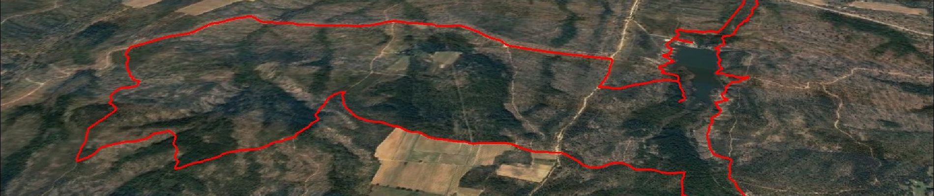
Boucle autour du Lac des Escarcets

affinetataille
User GUIDE
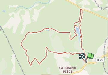

Length
13.5 km

Max alt
120 m

Uphill gradient
126 m
Km-Effort
15.2 km

Min alt
71 m

Downhill gradient
128 m
Boucle
Yes
Creation date :
2021-06-04 17:34:21.044
Updated on :
2021-06-11 07:01:38.817
5h00
Difficulty : Easy

FREE GPS app for hiking
 SityTrail
IGN / Geographical institutes
SityTrail Plus
The world is yours!
About
Trail Walking of 13.5 km to be discovered at Provence-Alpes-Côte d'Azur, Var, Le Cannet-des-Maures. This trail is proposed by affinetataille.
Photos


21 photos in total. Please click on a photo to see them all in the gallery.
Positioning
Country:
France
Region :
Provence-Alpes-Côte d'Azur
Department/Province :
Var
Municipality :
Le Cannet-des-Maures
Location:
Unknown
Start:(Dec)
Start:(UTM)
290436 ; 4800924 (32T) N.
Comments